Page 1 of 1
I need 1:18 maps of WWII Europe
Posted: Wed Apr 11, 2007 1:26 pm
by VMF115
Do you guys have any that I can down load and print out?
Posted: Wed Apr 11, 2007 1:30 pm
by VMF115
I am looking for scaled down maps of Germany and the eastern front.
but any will do.
I am just wondering if any one has done scaled down maps?
Posted: Wed Apr 11, 2007 1:49 pm
by tmanthegreat
Here's what I've done to make approximately 1:18 scale maps:
You can do a Google image search for a European map, or a map of the specific battle or region that you want. When you find one that looks suitable, copy just the thumbnail image. Print that image with maximum quality and cut it out from the paper. The map will be small, but sized well for 1:18. Also, remember there were many different types of maps used, some in color, some in black & white, etc.
In my experience, this trick has worked quite well! You could also print the full-sized image and scale it down, but copying and printing the thumbnail image is easier, I think.
Here's a few thumbnail maps you could try copying & printing of Europe as a whole, plus some more detailed regional areas


These may not be of the specific areas you requested, as I was working on this message before you made your post. Hope this helps nonetheless

Posted: Wed Apr 11, 2007 6:50 pm
by Spudkopf
G'day VMF115
Here's a 1/6th one that I did a long time ago (I think it was for the Normandy region), the text is only globally-gook but even at 1/6th scale in is barely readable, so if you scale it down even further to 1/18th it should be even less so.
It’s not much I’ll admit but here you go anyway.

Posted: Wed Apr 11, 2007 7:36 pm
by Spudkopf
Here's the same image reduced to 1/18th.........................

Posted: Wed Apr 11, 2007 8:20 pm
by VMF115
Spudkopf wrote:Here's the same image reduced to 1/18th.........................
There is no image, but I like it.
Posted: Wed Apr 11, 2007 8:23 pm
by Spudkopf
VMF115 wrote:Spudkopf wrote:Here's the same image reduced to 1/18th.........................
There is no image, but I like it.
Sorry but Photobucket seems to be having some issues at the moment, give it 30mins and there should be an image there eventually.
Posted: Wed Apr 11, 2007 8:26 pm
by VMF115
Thanks I will print them out as soon as i get the bugs worked out of my printer.
Posted: Wed Apr 11, 2007 8:26 pm
by VMF115
tmanthegreat wrote:Here's what I've done to make approximately 1:18 scale maps:
You can do a Google image search for a European map, or a map of the specific battle or region that you want. When you find one that looks suitable, copy just the thumbnail image. Print that image with maximum quality and cut it out from the paper. The map will be small, but sized well for 1:18. Also, remember there were many different types of maps used, some in color, some in black & white, etc.
In my experience, this trick has worked quite well! You could also print the full-sized image and scale it down, but copying and printing the thumbnail image is easier, I think.
Here's a few thumbnail maps you could try copying & printing of Europe as a whole, plus some more detailed regional areas
Thanks I will print them out as soon as i get the bugs worked out of my printer.
Posted: Wed Apr 11, 2007 8:53 pm
by Spudkopf
here's a link to a whole heap of German Army Topo maps, however most seem to be from the east.
http://lazarus.elte.hu/hun/digkonyv/topo/200e/
Posted: Wed Apr 11, 2007 8:55 pm
by VMF115
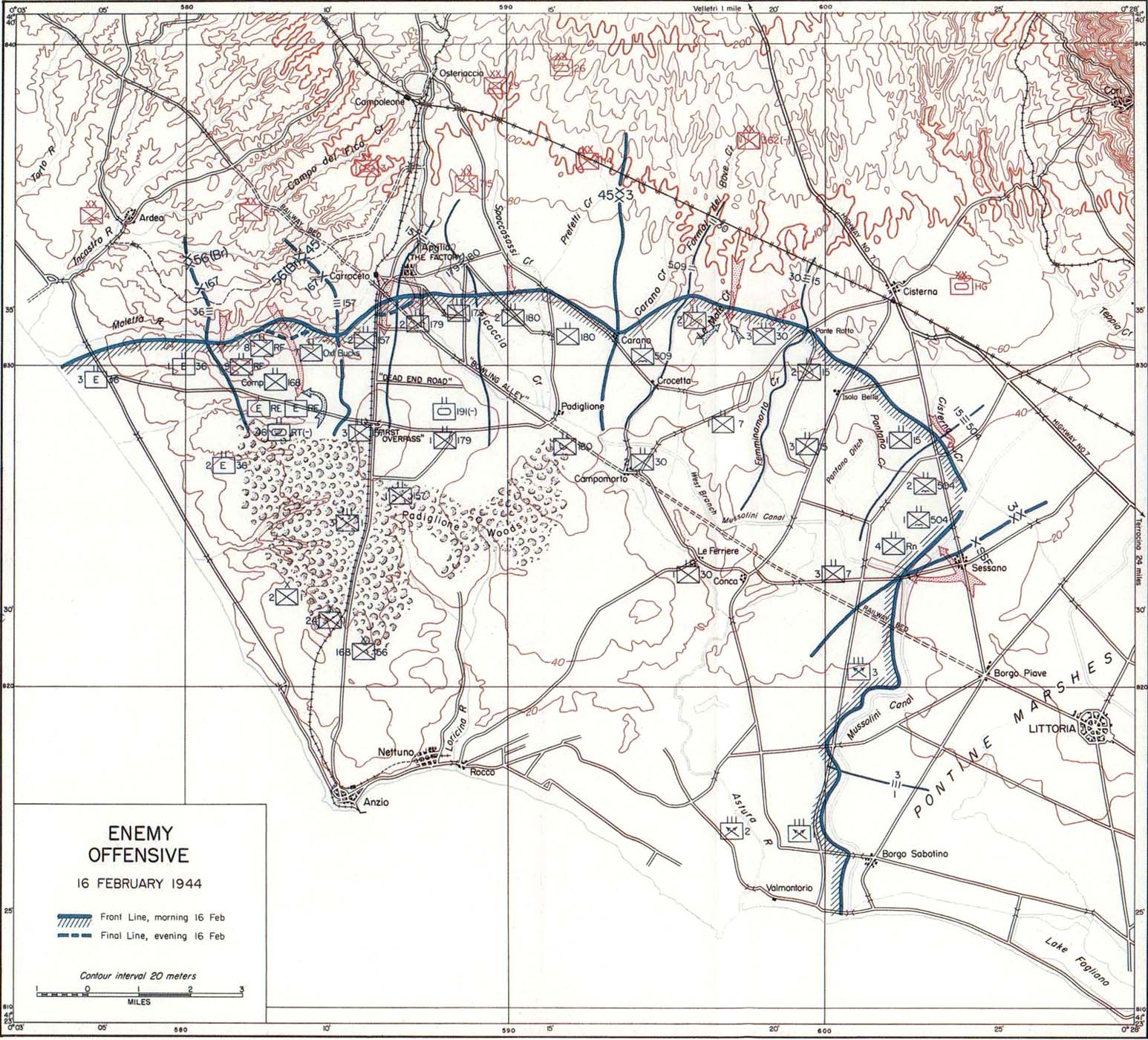
Are any of them of anzio?
Posted: Wed Apr 11, 2007 8:59 pm
by Spudkopf
No it appears there is only ones for Northern Italy
Posted: Wed Apr 11, 2007 9:00 pm
by VMF115
Spudkopf wrote:No it appears there is only ones for Northern Italy
That what I was thinking.
I am still looking.
Posted: Wed Apr 11, 2007 9:10 pm
by Spudkopf
Posted: Wed Apr 11, 2007 9:13 pm
by VMF115
Those are perfect I just need them in a bit smaller, a few in 1:16 and 1:18 scale
Posted: Wed Apr 11, 2007 9:16 pm
by MIGMADMAVIS
What you could do is you could print them out, and if you by any chance have a photocopier, then you could shrink it, or when you print it, you could choose the sampler option, and they make the pictures about 1/18 scale id say, its pretty hard to tell, and it fill the whole page full of them
Posted: Wed Apr 11, 2007 9:24 pm
by VMF115
MIGMADMAVIS wrote:What you could do is you could print them out, and if you by any chance have a photocopier, then you could shrink it, or when you print it, you could choose the sampler option, and they make the pictures about 1/18 scale id say, its pretty hard to tell, and it fill the whole page full of them
Using a photocopier will degrade the quality of the maps.
Posted: Wed Apr 11, 2007 9:29 pm
by MIGMADMAVIS
yeah thats true. Hmmmm, other than that I dont know what to tell ya other than searching for maps of germany through a search engine, and finding just the right size.
Hope this helps,
-Tobin
Posted: Wed Apr 11, 2007 9:31 pm
by Spudkopf
Here is one for rome if you can find 30-41 I think you would have Anzio
http://lazarus.elte.hu/hun/digkonyv/topo/200e/30-42.jpg
Posted: Wed Apr 11, 2007 9:37 pm
by Spudkopf
I'll see if I can shrink some down to 1/18th later today.
Posted: Wed Apr 11, 2007 11:30 pm
by Spudkopf
Sorry about the delay but Photobucket has been a tad sporadic today.
Anyway here you go..........

Hope that is what you wanted.
Posted: Wed Apr 11, 2007 11:55 pm
by VMF115
Spudkopf wrote:Sorry about the delay but Photobucket has been a tad sporadic today.
Anyway here you go..........
Hope that is what you wanted.
perfect as always
thank you kind sir